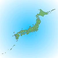
データセット詳細 / Details of the dataset
- ID
- 900001000000
- データセット名
Dataset Name 第3次メッシュshape (全国) データセット
The third order mesh shape (National)
- 画像
Images -


- 提供機関
Vendor シンフォニカ
Sinfonica
- 概要
Description
総務省統計局が保有する統計情報を磁気媒体化したものです。
空間情報科学に関わる研究者に広く利用していただくため、東京大学空間情報科学研究センターが財団法人統計情報研究開発センターから研究目的利用による承認を得て、変換、提供するものです。
データの座標系
日本測地系(経緯度座標)
キーワード
第3次メッシュ 全国
ご利用方法
「空間データ利用を伴う共同研究」による共同研究員が利用可能です。
データ一覧 / Data list
- ID
- 900001000001
- データ名
- 第3次メッシュshape (全国)
実施中プロジェクト / Active projects
人流データ分析による都市環境の変遷に伴う人間行動変容の解明
Human Behavior Change Associated with Changes in Urban Environments based on the Human Flow Data Analysis
駅周辺地域における災害時の安全確保に着目した空間特性分析
Analysis of spatial characteristic focus on emergency safety measures around the train station
大都市ニューターンの空间紧缩変遷メカニズム——日中都市比較研究
The trajectory and mechanism of spatial compacting and shrinking of new towns - based on the comparison of Chinese and Japanese cities
完了プロジェクト / Completed projects
九十九里地域における産業構造の変容に関する地理学的研究
The geographical study on the change of industrial structure in Kujukuri region
地方中心都市機能の変化に関する地理学的研究―千葉県茂原市を事例として―
A geographical study on a change of the urban structure in local central city; in case of Mobara city, Chiba prefecture
河川流路・分水嶺に着目した行政区分境界の地形的特長の抽出と考察
The extraction and prospect of topographical characteristics of administrative boundaries focusing on river channels and basins
インフルエンザによる幼稚園、小学校、中学校の学級閉鎖データを用いた空間疫学分析
Spatial epidemological analysis for infection routes using the data of flue-related temporary closing of classes <br> in kindergartens, elementary schools, and junior high schools
首都圏における新しい小売業態の立地展開に関する研究
Research on the location of the new retail type in the Tokyo metropolitan area
小学校欠席率によるインフルエンザ流行の時空間解析
The Spatio-Temporal Analysis of influenza by absentees from elementary school in Kitakyushu city
東京と大阪における都市の内部構造と水文環境の歴史的変遷
Historical transitions of spatial structures and water environments in Tokyo and Osaka
国内各地域におけるバイオマス分布・利用可能性に関する研究
A Study on the Regional Distribution and Availability of Biomass in Japan
清掃工場廃熱利用の地域冷暖房導入によるCO2排出削減量の推定
Estimation of CO2 reduction potential by using heat from incineration plants for district heating and cooling
地理的位置情報に基づく携帯電話の情報サービスに関する実証的研究
Study on the information services using mobile phone based on geographical location data
哺乳類の分布予測と気候変動による分布変化予測
pridicting distributions and effects of climate change on geographic distributions of wildlife
統合システム解析による空間詳細な排出・土地利用変化シナリオの開発
Spatially explicit emission and land-use change scenarios through Integrated System Analysis
都市構造からみた近隣商店街の存続要因に関する研究:葛飾区下町エリアを対象として
A Study on the Factors for Neighborhood Shopping Streets to Keep Active from the Viewpoint of Urban Structures : A Case of Old Town in Katsushika Ward
北陸地方における大規模商業施設の出店計画の基礎的研究
Location planning of a large-scaled surburban shopping mall in Hokuriku District
2011年東北地方太平洋沖地震にともなう土砂災害の解明
Investigation of Landslides Triggered by The 2011 off the Pacific coast of Tohoku Earthquake
都市環境文化資源の統合的な情報基盤構築に関する研究
Development of an Integrative Database System of Urban Environmental Cultural Heritage
大阪府と東京都におけるGISによる商圏分析と都市構造
Osaka Prefecture, and the trading area analysis and the urban structure in Tokyo by GIS
時空間セグメンテーションを用いた東京都市圏の居住者変容に関する分析
An Analysis on Population Change in Tokyo Metropolitan Area Using Spatio-Temporal Segmentation
人口減少社会での東京圏鉄道郊外地域の再編可能性に関する研究
Study on urban planning of Tokyo Metropolitan suburban area along railway lines in depopulating era
東北地方三陸海岸沿岸域における谷壁斜面の津波侵食の影響評価
Assessment of tsunami erosion on valley-side slopes along Sanriku coast in north-eastern Japan
データマイニングによる動物プランクトンの種多様性の地理的変動メカニズムの解明と将来予測に関する研究
Prediction of distribution and diversity for zooplankton by data mining
人の流れデータとオープンジオデータを活用した地域課題のマッピングに関する研究
The Study of the Mapping for Regional Issues through the Pflow and Open Geo-Data
Quantifying the Impact of Urban and Physiological Parameters on Outdoor Human Thermal Environments
NONE
文化的景観『対馬の石屋根倉庫』の実態と減少の要因に関する研究
Survey for the Condition of cultural landscape the Warehouses with slate in Thushima Island.
沖縄県の多様な生産条件に対応する集落営農・生産法人の農作業支援システムの開発
Development of the farm work improvement system for many variations of community farming and an agricultural production corporation in Okinawa
流動人口統計を用いた帰宅困難者の推定
Estimation of the Disaster Victim unable to Go Home using Floating Population Statistics
無電柱化が周辺の家賃に与える影響について ―東京都を事例として―
About the impact of non-utility poles on the rent in the around -As a case of Tokyo-
医療データと地理空間データを統合した患者動態の可視化に基づく医療サービスの評価
Evaluation of health care services based on patient dynamics visualized by synthesizing medical data and spatial data
3次元点群データの時空間解析に関する基礎的研究
Basic Research on Spatio-temporal Analysis of Three-Dimensional Point Cloud Data
団地再生に着目した歩行者道路ネットワークに関する研究
A study on pedestrian street network focusing on housing complex regeneration
統計・ビッグデータによる観光地域の内部構造と域内観光流動の分析
Analysis of the spatial structure of tourism region and intra-regional tourist flow using statistics and big data